GAF AG introduces Euro-Maps 3D for Ortho, a transnational, homogeneous and geometrically consistent digital elevation model and ortho layer that provides a perfect reference in x, y, z for the orthorectification of VHR data.
GAF to provide consulting services for Water Resources Management Information System in Mozambique
GAF AG, based in Munich, together with its partner AHT, from Essen, has been awarded the contract for developing the National Integrated Water Resources Management Information System (NIWRMIS) in Mozambique.
GAF AG winter donation campaign
GAF makes donations to good causes every year, with every euro donated by employees being doubled by the company. GAF was thus able to hand over a total of 4,318 euros to Tafel Neustrelitz e.V. and the Neustrelitz Forestry Office.
This winter, we were especially keen to help two institutions in the immediate vicinity of our Neustrelitz office. Since 1998, the food bank in Neustrelitz has been supplying users with meals and food every day. The Neustrelitz Forestry Office ensures that the forests close to the city continue to offer a diverse habitat for numerous animal and plant species.
We thank Tafel Neustrelitz e.V. and the Neustrelitz Forestry Office for their great work and are very happy to support them in their efforts to help society and with their planned reforestation measures.
Tajik trainees complete remote sensing training course at GAF
4-Week GAF training course successfully completed
GAF AG has successfully provided a training course on Remote Sensing and GIS as part of the GIZ-funded project "Technology-based Adaptation to Climate Change in Rural Areas (TCCA-RA) of Tajikistan and Kyrgyzstan". Three experts from the Design and Research Institute (FAZO) in Dushanbe, Tajikistan were trained from 16 June to 15 July 2022 at GAF’s headquarters in Munich as well as at the branch office in Neustrelitz. During this training course, the participants were introduced to operational production processes and projects that GAF is implementing in connection with climate-related mitigation and adaptation measures in various sectors.
A different kind of “geothermal energy” – GAF’s charitable donation helps create more social warmth on Munich's streets
In today’s difficult times, it is more important than ever to support those people who do not have the possibility to withdraw to within their own four walls to protect themselves from the cold outside. This is the reason why our charitable donation, collected before Christmas, goes to the association Münchner Kältebus e.V. this year.
Mohammed El-Kadi - A great entrepreneur and a long-time friend of GAF
We at GAF learned with great sadness about Mohammed’s unexpected death in Dubai last week.
He will stay in our memories as a remarkable and energetic person with a great sense of humour and profound foresight for innovative business decisions, which GAF had the opportunity to share and participate in.
GAF AG und BKG intensivieren ihre Kooperation im Hinblick auf die Bereitstellung von Multi-Source-Fernerkundungsdaten
Die GAF AG, einer der größten europäischen Anbieter von Geoinformationsdiensten mit dem Schwerpunkt Erdbeobachtung, hat eine internationale Ausschreibung des Bundesamts für Kartographie und Geodäsie (BKG) für die Bereitstellung von Fernerkundungsdaten gewonnen. Der daraufhin abgeschlossene Rahmenvertrag beinhaltet Beratungsdienstleistungen und Exklusivzugriff für das BKG und deren Bedarfsträger auf hochauflösende und sehr hochauflösende optische Satellitenbilder sowie Radaraufnahmen.
Mit dem Satellitengestützte Krisen- und Lagedienst (SKD) leistet das BKG einen unverzichtbaren Beitrag unkompliziert und schnell aufbereitete Informationsprodukte aus Geodaten und Fernerkundung an alle Bundeseinrichtungen bereitzustellen. Bei sicherheitsrelevanten und kritischen Herausforderungen ermöglicht das eine schnelle Reaktion.
GAF AG and BKG intensify their cooperation regarding the provision of multi-source remote sensing data
GAF AG, one of the largest European providers of geographic information services with a focus on earth observation, has won an international tendering process issued by the German Federal Agency for Cartography and Geodesy (BKG) for the provision of remote sensing data. The framework agreement concluded on that basis includes consulting services and the granting of exclusive access to the BKG and its users to high-resolution and very high-resolution optical satellite images and radar images.
With its satellite-based crisis and situation service, the BKG makes an indispensable contribution to providing straightforward and rapidly-prepared information products derived from geodata and remote sensing to all the federal institutions. This enables a rapid response in the case of security-relevant and critical challenges.
Cloud solutions for GAFs highly automated evaluation of satellite data for monitoring the complete agricultural areas of two Federal States in Germany
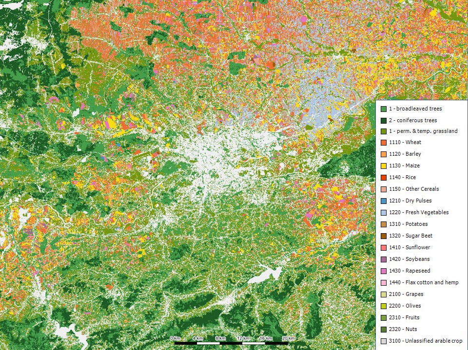
GAF AG has been again awarded contracts for the highly automated evaluation of satellite data for the monitoring of agricultural areas. The services have been extended to cover whole area of federal States. GAF will realize the entire process chain on the C-DIAS Platform Mundi Web Services as cloud solution, which offers new possibilities of processing, data storage volume and distribution.
GAF will be using a large quantity of high-resolution satellite data from the Sentinels 1 and 2, as well as Planet Scope data to check smaller plots.
The project’s objective will be the rapid, accurate and fully automated verification of numerous crop types and the compliance with agri-environmental and climate measures within the framework of the modernisation and simplification of the Common Agricultural Policy (CAP) in the EU for the awarding of subsidies.
Feels like home at work - #likehomeatwork
Greetings from our GAF Mobile Space. Most of us have safely landed there. We grabbed our gear, switched on our communication devices and beamed at the first sight of another GAF-human on our screens.
Yes, „we are fully operational“.
Completely independent from any company-dock-in, we manage daily to deal with familiar data- and Earth Observation challenges.
Entry into our GAF Logbook:„We find it exciting to see how new conditions change our everyday work. For the moment and to this extent they are of course limited to the duration of this emergency situation.
But they certainly provide an excellent basis for further modernization and flexibilization of our work environment for the time thereafter. We take this positive approach together“