The Copernicus Land Monitoring Service (CLMS) has just released a major update of High-Resolution Layers (HRLs) for Grasslands, Tree Cover & Forests and Croplands for the reference years 2022-2023. GAF AG will now continue to lead the production of those thematic HRL time-series for 2024, together with its partners GeoVille and VITO, and expand the delivery of data to include the UK.
The new release of High-Resolution Layers for the reference years 2022-2023 expands the CLMS portfolio with the addition of more recent information for the monitoring, understanding and management of the dynamics of forests, grassland and cropland in Europe. The new data will help the European Environment Agency (EEA) and its stakeholders in the implementation of several EU policies (e.g. Common Agricultural Policy, Nature Restoration Regulation, EU Forest Strategy for 2030) and provide even better support to environmental scientists and planning practitioners in their respective areas of use.
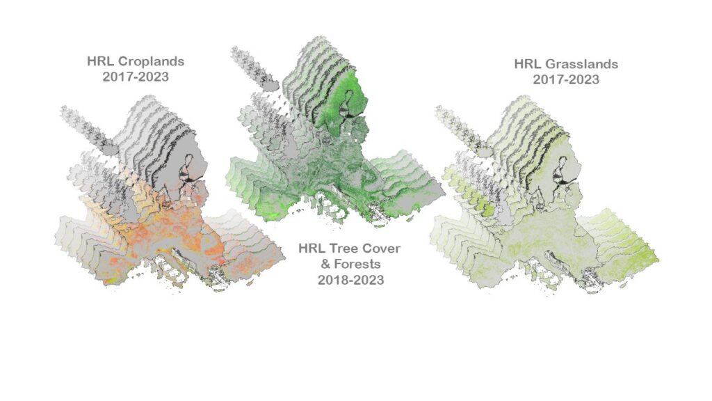
A first release took place earlier this year, in May, 2025 – for the reference years 2017-2021. This second release so soon after that constitutes a major step towards achieving timely and consistent updates of 20 annual variables such as crop types, harvest dates, secondary crop types, bare soil and fallow land duration, the number and dates of grassland mowing events, tree cover density and leaf types.
GAF AG leads the production of the HRLs for Vegetated Land Cover Characteristics with its partners GeoVille and VITO. It is on track to update the time-series and change layers for 2024 right on time for the next release in Q1 2026. This will also involve the expansion of the spatio-temporal coverage for all years and products to include the United Kingdom.
See also: https://land.copernicus.eu/en/news/2022-and-2023-status-layers-available-for-hr-vlcc-product-suite
Background information about the 1st release:
https://land.copernicus.eu/en/news/major-update-for-vegetated-high-resolution-layers
Copyright note: prepared using European Union’s Copernicus Land Monitoring Service information