GAF AG has been again awarded contracts for the highly automated evaluation of satellite data for the monitoring of agricultural areas. The services have been extended to cover whole area of federal States. GAF will realize the entire process chain on the C-DIAS Platform Mundi Web Services as cloud solution, which offers new possibilities of processing, data storage volume and distribution.
GAF will be using a large quantity of high-resolution satellite data from the Sentinels 1 and 2, as well as Planet Scope data to check smaller plots.
The project’s objective will be the rapid, accurate and fully automated verification of numerous crop types and the compliance with agri-environmental and climate measures within the framework of the modernisation and simplification of the Common Agricultural Policy (CAP) in the EU for the awarding of subsidies.
Since 2018, GAF has already been successfully carrying out various Monitoring Programmes within the GAP2020 as pilot projects within selected regions of various Federal States. These assignments have been commissioned by, among others, the Bavarian State Ministry for Food, Agriculture and Forestry.
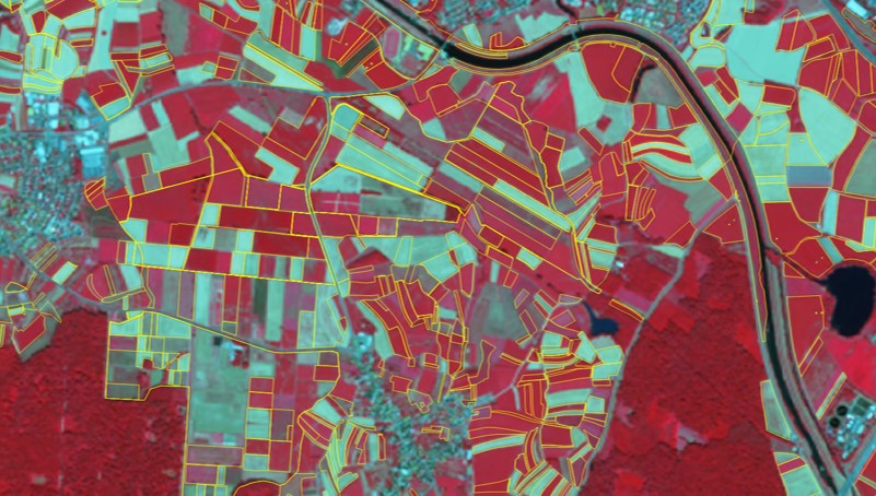
Photo: declared parcels on a satellite image SPOT6, summer 2018, False colour display